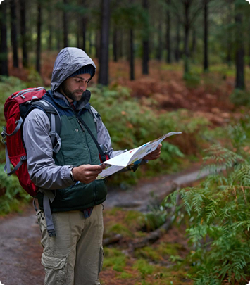
You might think you already know Everest, but the Three High Passes Trek shows you a whole new side of it. It’s not just the classic Everest Base Camp route; it goes a little higher, pushes you a little further, and rewards you with views that feel almost unreal.
Along the journey, you cross Kongma La (5,535 m), Cho La (5,420 m), and Renjo La (5,360 m), three high passes that challenge you in the best possible way. Some days, it honestly feels like you’re walking above the clouds. The mountains stand so close and so powerful that you forget how tired you are. And while your hands are busy gripping your trekking poles, your heart is busy soaking in one of the most breathtaking adventures on Earth.
This journey is not only undertaken in the mountains. It is also a trip through Sherpa culture, Buddhist monasteries, and old villages. You will go through Namche Bazaar, the busy Sherpa town, and gradually get lost among the silent villages such as Dingboche and Periche.
There are turquoise lakes and glaciers that look like frozen rivers, and each turn presents something new and jaw-dropping. Frankly speaking, it’s a kind of hike where even getting a breath feels like a bonus.
It’s tough. Really tough. But that’s part of the appeal. You get your legs ready, and your lungs, and your forbearance—but most of all, your mind ready. It has a rhythm: one step up, then one down, then you look around and realize you’re standing somewhere most people can barely dream of reaching.
 Country
Nepal
Country
Nepal
 Duration
15 Days
Duration
15 Days
 Difficulty
Moderate
Difficulty
Moderate
 Max. Altitude
5240 meters /
Max. Altitude
5240 meters / Prime Activity
Trekking
Prime Activity
Trekking
 Season
Autumn
Season
Autumn


Crossing Three High Passes: Kongma La, Cho La, and Renjo La are not merely high passes but also lead to views that you are likely to replay in your mind even after a long time. Each pass feels like a small personal triumph, particularly when the sky is that deep blue and the wind blows a breath of snow off the mountains.
Gokyo Lakes and Gokyo Ri: Have you ever seen water that turquoise in real life? It almost looks like it looks fake. That’s Gokyo Lake. And head a little higher up to Gokyo Ri, and there you are at a viewpoint that gives you Everest, Cho Oyu, Lhotse, and Makalu like a living postcard.
Kala Patthar Sunrise/Sunset: It is such an amazing experience to be on Kala Patthar (5,545 m) as the sun rises, with Everest catching the first light. Or at sunset, when the mountains turn orange and pink, and you just stand there, quietly proud you made it.
Sherpa Villages & Tengboche Monastery: Namche Bazaar is lively with markets and teahouses, and then there is Tengboche Monastery, which is the calmest place in the midst of the mountains. You can feel the Sherpa lifestyle, their piety, and a serenity that unexpectedly grounds you after weeks of hiking.
Everest Base Camp: The classic destination, yes—but here, it feels like everything you’ve hiked for comes together. Being at EBC (5,364 m) seems almost like a personal accomplishment, a mix of fatigue, wonder, and a little disbelief that you made it this far.
The expedition begins with a Kathmandu to Lukla flight, and frankly speaking, that flight itself is the tone-setter. Small airplane, tiny runway that is set on a mountaintop, and you are looking at mountains that are far too close. The trail starts at Lukla and goes through rhododendron forests and terraced fields to Phakding, where the first night in a teahouse offers you a glimpse of Sherpa hospitality. Yes, it is simple but easy: warm tea, wooden floors, and the muffled sound of trekkers chatting.
The trail leads to Namche Bazaar, the informal capital of the Khumbu. You will immediately feel the difference in energy, which consists of shops, cafes, prayer flags fluttering in the wind, and a market, where you can spend hours and see everyday mountain life. This is also the place (Namche) where your body actually begins to acclimatize. It is a good rest day here, strolling along narrow streets or hiking up to Tengboche Monastery, which is a very dramatic one, with Everest and Ama Dablam looming over the back of it.
Going out of Namche, the road ascends gradually to Dingboche, a remote village that is encircled by arid mountain ranges and expansive open valleys. The atmosphere becomes less dense, and each step seems to be a little more conscious. Trekkers start at Dingboche, then continue to Chhukung and finally to Cho La Pass, which is one of the three greatest passes. It is an incredible experience to cross but a challenging one: crampons, one should step softly on icy inclines, and an amazing view awaits on the other end, making it feel like a rite of passage.
This path also leads to Gokyo, home to the stunning turquoise glacial lakes and the challenging climb up Gokyo Ri, which offers one of the most panoramic views in the Khumbu. It sits beside the Ngozumpa Glacier, which is frozen and enormous, and the panorama of the surrounding mountains, Cho Oyu, Makalu, and Everest.
On the Gokyo side, the trekkers cross Renjo La Pass and reach Thame and Namche, and the final approach to Everest Base Camp is reached through Gorak Shep. The final climb to Kala Patthar to catch the sunrise or sunset is almost movie-like—the sky turns orange, the mountains glow, and you truly feel the distance you’ve covered and the height you’ve reached.
The homeward path is slow and reflective, retracing the same route through villages, forests, and winding ravines. When you finally fly out of Lukla back to Kathmandu, you return not just with memories but with a sense of achievement, a deeper understanding of the mountains, and perhaps a touch of disbelief that the journey you took was real.
Airport pick up and drop-off by private vehicle
All Domestic flights and airport tax as listed in the itinerary
Standard meals (breakfast, lunch and dinner) during the trek
Teahouse/lodge accommodation during the trek
Government-certified guide
Sagarmatha National Park entry permit
Pasang Lhamu Rural Municipality entry permit
Comprehensive first aid kit with oximeter
Nepal entry visa fee
Your Travel Insurance (compulsory)
All the expenses of personal nature
Any kind of drinks and desserts during the trek
Tips to guide and porter (Tipping is expected)
Travel insurance is absolutely essential for anyone planning the Everest Three High Passes Trek. Medical emergencies, evacuation, and trip interruption are just a few of the issues that standard travel insurance should cover. Trekking in such remote areas carries risks such as altitude sickness, injuries, flight delays, and sudden weather changes.
Helicopter evacuations from high points like Gokyo or Everest Base Camp can cost thousands of dollars, and having insurance ensures you are not left exposed.
When selecting a policy, make sure it includes:
coverage up to at least 5,500–6,000 meters
Emergency medical expenses
Repatriation and evacuation
Trip cancellation and delay coverage
Coverage for lost luggage or other items
It is advisable to purchase insurance before arriving in Nepal, as most policies require coverage to begin before leaving your country of residence. Carry both a physical and electronic copy of your policy while trekking. Guides may request proof of insurance before the trek begins or during unfavorable weather conditions.
Nepal offers a visa-on-arrival policy for citizens of most countries at Tribhuvan International Airport in Kathmandu. For trekkers, this is the most convenient way to enter Nepal without prior application. The visa is strictly for tourism purposes, which includes trekking, sightseeing, and cultural tours.
In 2026, visa costs are approximately
15 days: USD 30
30 days: USD 50
90 days: USD 125
The visa allows multiple entries but does not cover trekking permits, guide fees, or travel insurance. Trekkers should carry copies of their visa, trekking permits, and insurance, as these may be checked at official checkpoints along the trail or checkpoints. If your expedition exceeds the visa period, you must renew it at the Immigration Office in Kathmandu to avoid fines or penalties.
The Everest Three Passes Trek is closely connected with the culture, traditions, and everyday life of the Khumbu region, where the majority of the population belongs to the Sherpa community. The Sherpas are known worldwide as resilient mountaineers with a deep understanding of the Himalayas, yet at their core, they maintain a strong spiritual and communal lifestyle.
Tibetan Buddhism is the main religion of the area, evident in the prayer flags fluttering along high passes, mani walls inscribed with religious mantras, stone stupas, and centuries-old monasteries, including those in Tengboche and Pangboche. As trekkers move through the villages, it becomes clear that religion is not separate from daily life. Instead, it is woven seamlessly into the people’s routines, festivals, architecture, and social values.
Cultural interactions on the trek are subtle but significant. Life in the high Himalayas is straightforward and disciplined, shaped by altitude, climate, and tradition. The local people are hospitable, offering warmth through teahouse stays, shared meals around a fire, and quiet conversations over cups of butter tea.
Masked dances, rituals, and community gatherings such as Mani Rimdu and seasonal festivals further reflect the integration of Buddhism and local culture. Walking the Three Passes is therefore not just a physical journey through dramatic scenery, but also a cultural experience, passing through a Himalayan society that continues to uphold its traditions despite increasing exposure to global trekking tourism.
The Everest Three High Passes Trek is regarded as being one of the most difficult treks in the Khumbu region. The trek takes you over three high passes, each above 5,300 meters. The expedition challenges not only your physical stamina but also your mental resilience. It is the kind of adventure that pushes your limits, tests your patience, and ultimately rewards every effort with views and experiences that few other journeys can match.
Being at a high altitude in the Everest region for a long period of time is one of the greatest challenges of this trek. Anything above 5,000 meters exposes your body to thin air, making even the simplest tasks—climbing a steep slope or taking a photograph—surprisingly tiring. Altitude sickness is a real concern, so acclimatization days are essential.
Namche Bazaar and Dingboche are the main acclimatization stops, but there is no escaping the fact that your heart beats faster, your breathing quickens, and your muscles feel unusually heavy. It is physically demanding, yet there is something slightly thrilling about using your body in such a raw, high-altitude environment. It feels alive in a way that lower altitudes rarely offer.
Trekking days can range from five to nine hours on rocky, uneven, and sometimes ice-covered paths. The expedition includes steep climbs to high passes, descents that test your knees and ankles, and narrow trails that challenge your resolve. Even a light backpack adds to the burden.
One day your legs ache, and your lungs burn, and the next day the trail may feel so easy you think you could run the whole distance, only to reach a spot where you must stop. Trekking poles become a constant companion, and pacing yourself is not just advice—it is essential for safety. Despite the effort, each summit or ridge crossed offers a small triumph, a sense of victory over the physical and mental challenges of the mountains.
Even in spring and fall, conditions can shift quickly, especially at high altitudes. On the passes, sudden snow, icy patches, or strong winds can make trekking far more difficult than on a clear, sunny day. Monsoon trails are slippery, and winter snow makes paths even more challenging.
Sometimes, it requires cooperation with other trekkers. You must be ready to pause, wait, or adjust your pace, learning to accept that in the Himalayas, nature dictates the rhythm, not you.
This trek challenges both body and mind. Long days, early mornings, cold nights, and the relentless rhythm of climbing can be exhausting. Feelings of uncertainty, fatigue, or frustration are common, especially when the next pass seems impossibly far.
Yet the journey is also awe-inspiring. Standing on a high ridge with Everest or Ama Dablam glowing in the sunlight, hearing the wind rustle the prayer flags, or walking silently through a quiet valley creates unforgettable moments. Psychologically, the trek teaches perseverance, patience, and the simple satisfaction of moving forward step by step—brutal, exhausting, and at the same time breathtakingly beautiful.
Along with the national park permit, trekkers are also required to have the Khumbu Pasang Lhamu Rural Municipality Permit, a local area permit specific to the Khumbu region, home of the three high passes in Everest. This permit replaces the need for a TIMS card in this area.
This local permit is often checked during the early stages of the trek, and trekkers without it may be stopped at checkpoints.
The use of a TIMS card on the Everest Three High Passes Trek is less prominent than in other trekking areas. Traditionally, TIMS was required in most trekking regions in Nepal to register trekkers for safety and monitoring purposes.
According to recent sources, in the Everest region, the Khumbu Pasang Lhamu Rural Municipality Permit has replaced the TIMS card for most trekkers.
If you are interested in a similar adventure,
It is nearly all teahouse-based accommodation on the Everest Three High Passes Trek. The term may sound simple, but these lodges play a significant role in the trekking experience. Teahouses in lower villages like Lukla, Phakding, and Namche Bazaar are fairly comfortable. Rooms usually have twin beds, mattresses, pillows, and blankets, and some lower-elevation lodges offer attached bathrooms and hot showers, though these become rare as you gain altitude. There is something oddly peaceful about sitting in a warm dining room with the smell of tea and food after a long day on the trail, especially given the remoteness of the surroundings.
The higher you trek, the simpler and more practical the accommodation becomes. In destinations like Dingboche, Lobuche, or Gokyo, rooms are smaller, walls are thinner, and heat is limited to the common dining room. Nights can be bitterly cold, and this is when you truly appreciate a good sleeping bag. Yet, there is something unforgettable about these elevated teahouses: the sound of wind outside, quiet chats with fellow trekkers, and waking up to frozen windowpanes and stepping outside to towering peaks.
At the highest overnight stops, such as Gorak Shep, accommodation is very basic—but it serves its purpose. The lack of luxury is overshadowed by the realization of where you are: sleeping at over 5,000 meters near the Khumbu Glacier and some of the tallest mountains in the world isn’t meant to feel indulgent. It is gritty, authentic, and hard-earned—and that is what makes it memorable.
Meals on the Everest Three High Passes trail are designed to maintain energy rather than impress, though they often do both. The main meals, usually lunch or dinner, revolve around dal bhat, a plate of rice served with lentil soup, vegetables, and pickles. It’s filling, nourishing, and easy to digest—a key factor when trekking at altitude. Most trekkers rely on it daily, especially because refills are usually unlimited, giving the body comfort and reassurance.
Teahouse menus can be surprisingly varied, even in smaller villages. You’ll find noodles, fried rice, pasta, soups, momos, eggs, pancakes, porridge, and baked goods. You’ll even find bakeries and fresh baked goods in Namche Bazaar. At higher altitudes, menus shrink, and prices rise, since all food must be carried by porters or pack animals. Still, a hot bowl of noodle soup or a plate of potatoes is incredibly satisfying after hours of exertion in cold, thin air.
Coffee and tea are essential on the trail. Options such as ginger tea, lemon tea, garlic soup, and black tea not only keep you warm but also aid digestion and overall comfort at high altitude. Appetite tends to decrease the higher you go, and some meals may be harder to finish than expected. Eating slowly, staying hydrated, and consuming warm, simple foods makes a noticeable difference in how you feel the next morning.

Tenzing Sherpa
Have questions? Our travel specialists are here to help plan your perfect adventure.
Chat on WhatsAppThere's something about that first morning at Tribhuvan Airport that gets your pulse going, and it's not just the coffee. You're about to board one of the most talked-about mountain flights in the world, and no amount of reading about it fully prepares you for the real thing. The 45-minute flight to Lukla's Tenzing-Hillary Airport is thrilling from the moment the plane banks into the hills. You'll catch terraced slopes, deep river gorges, and if the clouds cooperate, an early glimpse of Everest peeking above the ridgeline. Landing at Lukla is its own experience; the runway is short, steep, and carved right into the mountainside. First-timers tend to grip their armrests. That's completely normal. Once you're on the ground, take a breath. There's no rush. Use this time to reorganize your pack, double-check your gear, and let the mountain air sink in. When you're ready, the trail to Phakding begins, a pleasant walk that winds down through pine forests, over swaying suspension bridges, and past the first of many Sherpa villages you'll come to love, including Chheplung and Ghat. The Dudh Koshi River accompanies you most of the way, loud and glacier-grey and surprisingly comforting. It's a relatively gentle introduction to the trek, a few hours of easy walking that ends with a warm teahouse, a hot meal, and your first night in the Khumbu.
If yesterday was the warm-up, today is where the trek truly begins to show its character. You'll leave Phakding after an early breakfast and head north along the Dudh Koshi, crossing it again and again on suspension bridges that flutter with prayer flags. There's a meditative rhythm to it after a while: the sound of the river below, the creak of the bridge underfoot, and the bells on passing yak trains. Villages like Bengkar, Monjo, and Jorsalle dot the trail. At Monjo, have your permits ready; this is the entry point to Sagarmatha National Park, and rangers will check your paperwork here. Just beyond Jorsalle, you'll cross the Hillary Suspension Bridge, arguably the most iconic crossing on this entire route. Then comes the climb to Namche. It's steep and honest, a sustained uphill push through dense forest that tests your legs and your patience in equal measure. But every few switchbacks, the trees thin out just enough to reward you with views of peaks, including Thamserku. Some trekkers spot Everest for the very first time from this trail. Keep your eyes up. Namche Bazaar, when it finally reveals itself around a final bend, feels almost surreal, a horseshoe of colorful buildings stacked into a mountain bowl, buzzing with trekkers, traders, and Sherpas. Check in, settle down, and let yourself feel proud. Today was a good day.
Rest days on a trek can feel like a guilty pleasure until you realize just how essential they are. At 3,445 m, your body is working harder than it looks. Namche's acclimatization day is built into the itinerary for good reason: skipping proper adjustment here is one of the most common mistakes trekkers make. That said, the goal isn't to sit in bed all day. A short morning hike does wonders for helping your body adjust. One of the best options is the climb up to the Everest View Hotel, a trail that passes through juniper and rhododendron forests and opens onto some genuinely jaw-dropping views of Ama Dablam, Thamserku, and, of course, Everest itself. The Sherpa Cultural Museum and Khumjung Monastery are also worth the walk if you have the legs for it. Come back down by midday, have a proper lunch, and let yourself wander Namche's lanes at a slow pace. The town has good bakeries, surprisingly decent coffee, and shops that sell everything from wool socks to yak cheese. Drink plenty of water, skip the evening beer (altitude and alcohol don't mix well), and get a solid night's sleep. Tomorrow the real climb continues.
Leaving Namche involves an immediate test, a steep climb right out of town that wakes up muscles you'd half forgotten about. But once you're up on the ridge, the payoff is immediate. The Mahalangu Himalayan Range opens up ahead of you, and on a clear morning, the sight of Everest, Lhotse, and Ama Dablam lined up together is the kind of thing you'll describe to people for years. The first village you'll reach is Khyangjumpa, small, quiet, and set in a forest of rhododendrons. Stop here for tea if you need it. The descent that follows drops you sharply down to the Dudh Koshi River at Phunke Tenga, a pleasant settlement at the confluence of two rivers where most trekkers stop for lunch. From there, the trail climbs again through forested hillside. Keep your eyes open along this stretch; Himalayan Thar, musk deer, and pheasants are commonly spotted. The final push up to Tengboche is steep enough to make you earn it. But Tengboche itself is worth every step. Sitting above the treeline with Ama Dablam dominating the skyline behind it, the monastery here, the largest in the Khumbu, has a stillness to it that's hard to describe. Settle in for the evening, find a warm corner in the teahouse, and let the mountains speak for themselves.
Start the morning at Tengboche Monastery before the day's trek pulls you away. The early hours at the monastery, butter lamps lit, monks in quiet ritual, and mountains glowing in the sunrise are among the most peaceful moments this entire route has to offer. Take your time here. From Tengboche, you'll descend gently to Deboche through forest before crossing the Imja Khola on a suspension bridge and climbing to Pangboche, one of the highest permanently inhabited villages in the valley. The Pangboche Monastery, perched on a rocky outcrop above the village, is the oldest in the region and carries with it centuries of Sherpa history, including the once-famous (and since disputed) yeti relics it used to house. As you climb beyond Pangboche, things start to feel noticeably different. The trees thin and then disappear entirely. The trail opens up into high alpine terrain, and the scale of everything. Views of Lhotse, Island Peak, and Ama Dablam follow you the whole way. Dingboche sits at 4,390 m in a wide, open valley surrounded by stone-walled fields that protect crops from the wind. It's a no-nonsense trekking hub, practical, a little windswept, and beautiful in its own high-altitude way. Dinner, sleep, repeat.
This is the point where your itinerary quietly diverges from the crowds heading to Everest Base Camp. While most trekkers continue straight up the valley, you veer northeast into the Imja Valley, and the trail immediately feels wilder and less trafficked for it. The walk to Chukkung is shorter and more relaxed than recent days, which is a deliberate gift from the itinerary. The elevation gain is modest, the trail is well-worn, and the landscape is starkly beautiful, no trees at all now, just low scrub, open glacial plains, and the growing presence of enormous peaks. Ama Dablam rises to your right. Lhotse, Nuptse, Island Peak, and Makalu fill the view ahead. You'll pass through Bibre, a small yak-herding settlement, before the final stretch into Chukkung. At this altitude, even a gentle walk can feel tiring; that's perfectly normal and not something to push through too aggressively. Set your pace early and stick to it. Chukkung itself is tiny, a loose gathering of teahouses at the end of the valley, ringed by glaciers. It has a frontier-outpost feel to it. Tomorrow, you'll cross the first and highest of the three passes. An early night makes sense.
This is a day that demands respect. Kongma La is the highest of the three passes at 5,535 m, and the approach is no gentle stroll. You'll be up before dawn, headlamp on, setting off into the dark and cold with the serious, quiet focus that high-altitude mornings tend to inspire. There are two route options to the pass. The more direct path climbs northwest over a moraine field left by the Nuptse Glacier, loose rocks, glacial debris, and potentially some small glacial lakes depending on the season. It's steep but efficient. The other route swings back through Bibre with a more gradual incline. Your guide will help you choose based on conditions. Whichever way you go, the summit of Kongma La delivers. Standing at 5,535 m with Lhotse, Makalu, Ama Dablam, Island Peak, and the entire sweep of the Khumbu Glacier laid out before you is a genuinely humbling moment. Take it in. The descent to Lobuche is technical, with loose rock, icy patches, and a challenging crossing of the Khumbu Glacier with its own ups and downs. Tired legs on uneven terrain require concentration, so don't rush this section. By the time Lobuche appears, you'll have earned every hot drink and warm blanket it has to offer.
Back on the main EBC trail now, you'll join the broader stream of trekkers heading toward the mountain. There's an energy to this section, everyone moving with purpose, everyone chasing the same dream. The first leg to Gorakshep takes you through increasingly dramatic moraine terrain, loose stones, icy patches, and the creeping sensation that you're walking into something genuinely enormous. Gorakshep itself is sparse and functional, little more than a rest stop. But the views from here of Pumori and the glacier are outstanding. After a quick rest and some food, you'll push on to Everest Base Camp. The trail hugs the edge of the Khumbu Glacier, winding through boulders and frozen ridges until the prayer flags and colorful expedition tents come into view. You've made it. It's worth noting that Everest's actual summit isn't visible from Base Camp; the mountain's bulk hides it behind the ridge. But what you do see is the sheer scale of the Khumbu Icefall, the sound of ice cracking in the distance, and the tents of expedition teams preparing for their own ascents. Stand here and let it land. Then it's back to Gorakshep for the night. Tomorrow promises something even better.
Wake up early. The hike to Kalapatthar is best done in darkness so you arrive at the summit just as the sky starts to lighten. Because watching the sun rise over Everest from 5,545 m is, quite simply, one of the finest things you can do with a morning on this planet. The summit pyramid catches the first light, glowing amber and pink before the rest of the world wakes up. Photographs don't do it justice, but take them anyway. After soaking it all in, descend to Gorakshep for breakfast, then retrace steps to Lobuche. Here, you leave the classic EBC trail behind and head west toward Dzongla. The trail passes through the Dughla junction, climbs gently, and rolls through rocky, exposed terrain with views of Cholatse growing ahead of you. Dzongla is a small, quiet village perched between the worlds of Lobuche and the Cho La Pass. It's modest but welcoming, and the mountain views from here are great. Ama Dablam, Taboche, and Cholatse are the kind you linger over long after dinner.
Another big day, and an early start is non-negotiable. Afternoon winds at Cho La can make the crossing genuinely dangerous, so you'll be moving well before sunrise. The initial climb out of Dzongla is rough, with loose glacial rocks underfoot and a gradient that doesn't give you any early favors. But as you gain height, the Chola Lake appears in the bowl below, steel-blue and perfectly still, and Ama Dablam watches you from across the valley. These things keep you moving. At 5,420 m, the pass opens up. The Ngozumpa Glacier, Nepal's longest, sprawls below you in one direction. Gokyo Valley, Makalu, and Lhotse fill the other. Prayer flags snap in the wind. It's spectacular in the most complete sense of the word. The descent requires care; slippery glacial rock gives way to loose terrain as you drop to Cho La Phedi and then Dragnag, where you can rest and refuel. A final gentle walk along the edge of the Ngozumpa Glacier leads to a glacier crossing, and then a short climb brings you to Gokyo. Gokyo is one of those places that earns your love immediately. The village sits beside a high-altitude lake of impossible turquoise, backed by Gokyo Ri and surrounded by peaks. After the intensity of the last few days, it feels like somewhere the world has been kind enough to set aside just for you.
No pack hauling to a new destination today. Just the mountain, the lake, and a day that belongs entirely to you. Begin before sunrise again, and climb Gokyo Ri. It's steep, and there's no disguising that. But the panorama from the 5,360 m summit is worth every burning step: Everest, Lhotse, Makalu, and Cho Oyu are all visible at once, with the Ngozumpa Glacier flowing beneath you like a frozen river. On a clear morning, this is arguably the finest viewpoint on the entire trek. Watch the sunrise. Take too many photos. Sit with it. Descend to the village for a proper breakfast; eggs, porridge, maybe a pancake if the teahouse is feeling generous, and then spend the rest of the day as you like. The Gokyo Lakes are worth exploring; the Fourth Lake (Thinak Tsho) and Fifth Lake (Ngozumba Tso) are quieter and less visited, set in landscapes that feel genuinely remote. They're worth the walk. Come back to the village in the late afternoon, have a long dinner, and rest well. Tomorrow is the third and final pass.
The last of the three passes. There's a bittersweet weight to that as you set off early from Gokyo, threading through cairns and prayer flags on the trail toward Renjo La. The terrain is rocky moraine for much of the approach, demanding steady footwork and a consistent pace. The final stretch to the summit is the toughest section, steep, exposed, and relentless. But push through it, because what waits at the top is extraordinary. From 5,360 m, the Gokyo Lakes spread below you like scattered mirrors. Everest, Lhotse, Makalu, Cho Oyu, and Ama Dablam all share the skyline. This pass also served historically as a trade route to Tibet, and on a quiet morning you can almost feel that history in the air. Snow leopards and red pandas roam this region too, though spotting them requires luck and patience. After time at the summit, descend to Lungden, a small, peaceful village that will be your home for the night. The trail drops through changing terrain, and by the time you arrive in the afternoon, the sense of accomplishment is enormous. Three passes. Done.
Today is largely about letting gravity do some of the work. The descent from Lungden begins gently, then takes you over a small hilltop and down to cross a stream, before a few hours of steady walking brings you to Thame. Thame sits at 3,820 m and feels like a living piece of Khumbu history. The monastery here is one of the most respected in the region, and a short visit is always worthwhile; there's a quiet dignity to the place that lingers with you. Stop for lunch or tea and enjoy the slower pace. From Thame, the trail continues down through forests of pine and rhododendron, past Samde and Thamo villages, and across more suspension bridges. It's the kind of trekking that lets your mind wander; familiar terrain now, heading home. Namche announces itself with that final uphill push it always insists on, and then you're back in the bowl of the bazaar, surrounded by its familiar noise and energy. You've completed a full circuit of the Everest region. Walk slowly through town tonight. You've earned the right to take it all in.
The last full day on the trail. Breakfast in Namche, then down through the zigzag stone steps that once seemed so daunting and now feel like old friends. The Hillary Suspension Bridge swings underfoot as you cross the Dudh Koshi one more time. The route back to Lukla is familiar but never quite the same going down: different light, different legs, and a different kind of awareness now that the end is in sight. Monjo, Jorsalle, and Phakding roll past in comfortable sequence. Stop for lunch at Phakding, then push on through Chheplung and up the final climb into Lukla. Arriving back in Lukla feels strange in the way that completing something significant always does. The same airport, the same guesthouses, but you're not the same person who landed here two weeks ago. Check into your lodge, clean up, eat something warm, and celebrate properly this time.
The alarm goes off early one last time. Breakfast in Lukla, bags packed, and then the walk up to Tenzing-Hillary Airport for the flight home. The flight back to Kathmandu is the same 45 minutes it always was, but you'll watch it differently now. The peaks that were just photographs before the trek are familiar faces. The valleys below trace the exact route your boots covered. Terraced fields and green hillsides appear as you descend in altitude, the world softening around you. You'll land at Tribhuvan's domestic terminal within the hour. From there, it's back to your hotel, back to hot showers, flat roads, and the particular culture shock of returning from the mountains. Take your time with it. The Himalayas have a way of staying with you long after you've left.
Because your next adventure is impatiently waiting for you.
Last Minute Note: Grab incredible deals on the last minute departure / Book spontaneous trips to hip destinations with limited-time offers and discounted price
Before you think of or actually plan any adventurous or relaxing tours, travels, or treks with Nepal Outdoor Expeditions.